


Contact Info
- Phone 1:
- 218-235-1299
Basics
- Number of Sites:
- 33
Amenities
Basic Amenities
- Drinking Water
- Vault Toilets
Special Features
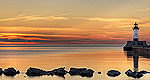
- Fishing
Additional Conveniences
- Boat Ramp
Details
Season
Open through Wed Sep 25 2013Location
Getting There:GPS Info. (Latitude, Longitude):
47.81556, -91.73139
47°48'56"N, 91°43'53"W
From Ely, Minnesota, travel about 10.3 miles south on State Highway 1 toward Lake Superior. Turn left onto the campground road.
Basic Info
- Total Sites:
- 33
Closer to shore, visitors can enjoy an afternoon of swimming at the campground's grassy beach, hiking the 1-mile Kawishiwi River Forest Trail or trying their luck at fishing for northern pike, perch and walleye. A boat ramp is located on-site.
View recreation guides and maps of hiking trails and canoe routes in the national forest.

