


Contact Info
320 N. Highway 53
Cook, MN 55723
- Phone:
- 218-666-0020
Basics
- Length:
- 7 miles
- Difficulty:
- Intermediate,
Difficult
- Time:
- 2.5 - 3.5 hours
Description
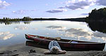
This trail follows gentle terrain with a few steep, rocky sections and some wet areas. A short distance from the trailhead at Lake Jeanette, you will cross the Echo Trail. Watch carefully for traffic before crossing. Between Lake Jeanette and Nigh Lake, the trail was raised above the sphagnum moss so you can keep your feet dry while crossing the black spruce bog. Pitcher plants abound. On the loop between Nigh and Astrid Lakes there are several areas with huge boulders that were deposited by the glaciers as they receded 10,000 years ago. These glacial erratics are scattered along with scenic vistas on this stretch of ledge rock. Watch for rock cairns marking the trail here. Back country campsites are available on the lakes (see map). Please Leave No Trace of your visit.
Features 7 miles of hiking trail connecting 4 small lakes Access at Lake Jeanette Campground and Forest Road 200 Views of Astrid, Pauline and Nigh Lakes 6 back country campsites with fire grate, latrine and tent pads Wilderness-style camping without wilderness permits and regulations.
Details
Length:
Difficulty:
Difficult

