


Basics
- Number of Sites:
- 12
Amenities
Basic Amenities
- Drinking Water
- Vault Toilets
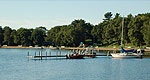
Special Features
- Fishing
Additional Conveniences
- Boat Ramp
Details
Season
Open through Tue Oct 15 2013Location
Getting There:GPS Info. (Latitude, Longitude):
48.13222, -92.29583
48°7'56"N, 92°17'45"W
From Orr, Minnesota, take St. Louis County Road 23 for 16 miles to Buyck. At Buyck, County Road 23 turns into County Road 24. Continue on County Road 24 for 8 miles to the Echo Trail. Turn right onto the Echo Trail and continue 12 miles to Jeannette Lake Campground.
Basic Info
- Total Sites:
- 12
- Tent Sites:
- 1
The surrounding national forest offers a wide variety of recreational opportunities, including hiking in secluded woodlands and canoeing in pristine lakes and rivers.
View recreation guides and maps of hiking trails and canoe routes in the national forest.

