


Basics
- Location:
- Northwest of Denver
- Setting:
- Mountainous
- Length:
- 2 mile roundtrip
- Difficulty:
- Easy
- Time:
- 1 to 1.5 hours
- Trailhead Elevation:
- 9500 feet
- Elevation Change:
- -200 feet
Basic Directions
From Granby, northwest of Denver, take Highway 125 to County Road 4 (FDR 123), about 3 miles south of Willow Creek Pass and 17 miles north of US Highway 40. Follow this gravel road along Willow Creek approximately 6 miles to the Stillwater Pass junction. At the Stillwater Pass junction, take County Road 456 for .5 miles to the Lost Lake Trailhead and parking area.
Description
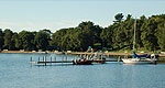
Pristine lake.
Tour Companies
Vista Verde Guest Ranch - Hiking
- Near Steamboat Springs
- Hiking
- 970-879-3858
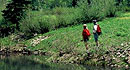 At Vista Verde Ranch, hiking is one of the many activities you can try during your all-inclusive Colorado ranch vacation. Our guides offer a customized outdoor experience whether you want to rock climb, mountain bike, fly fish or horseback ride.
Helpful Links
Tour Companies
Vista Verde Guest Ranch - Hiking
- Near Steamboat Springs
- Hiking
- 970-879-3858
Details
Location:
Northwest of Denver
Setting:
Mountainous
Length:
2 mile roundtrip
Difficulty:
Easy
Time:
1 to 1.5 hours
Trailhead Elevation:
9500
Elevation Change:
-200

