


Contact Info
201 Minnesota Avenue E.
Walker, MN 56484
- Phone:
- 218-547-1044
Basics
- Length:
- 68 miles
- Difficulty:
- Intermediate,
Difficult
- Time:
- Multi-Day
Description
Each season harbors it's own beauty along the North Country Trail. In the spring, the Forest is dotted with wildflowers, morel mushrooms and the bright green of emerging aspen leaves. Mid-summer brings out wildlife, wild berries and northern lights. Autumn brings waves of reds, yellows and oak browns across the Forest to North Country Marathon enthusiasts, and winter brings a new array of recreation opportunities for visitors....skiing, snowshoeing and winter camping.
Details
Length:
Difficulty:
Difficult
Time:
Additional Details:
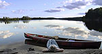
The North Country Trail passes through the Chippewa National Forest as part of the larger North Country National Scenic Trail. The trail travels over 3,200 miles from Crown Point, New York to Lake Sakakawea, North Dakota. Eventually the trail will link to the Appalachian Trail to the Lewis and Clark and Pacific Crest Trail. When completed, the North Country Trail will be the longest continuous foot path in the United States. Within the Chippewa National Forest, the North Country Trail meanders through 68-miles of forested lake country. White Pine forests and river overlooks beckon travelers along this scenic route. Discover old homesteads hidden in the "Woodtick Fields" and enjoy the cool waters of the many backcountry lakes.
RULES OF THE TRAILThe North Country Trail is intended for foot travel only. Motorized vehicles, including motorcycles, snowmobiles and three/four wheelers are not permitted on the trail. Please observe basic trail rules:
- Show respect for other Forest visitors and the natural environment
- Leave areas the way you would like to find them
- Use caution with fire
- Treat plant, animal and human neighbors with consideration
National Scenic Trail from New York to North Dakota

